July is PDX S.P.L.A.S.H. Month!
Stewardship | Preservation | Local | Arts | Sustainability | Heritage
The Portlandia Mermaid Parade is proud to be an official PDX SPLASH Month event!
We are the culminating shellabration of a month long series of activities and events focusing on water awareness!
We are the culminating shellabration of a month long series of activities and events focusing on water awareness!
About
S.P.L.A.S.H. stands for Stewardship, Preservation, Local, Arts, Sustainability, and Heritage. PDX SPLASH month is an opportunity for Portlanders to celebrate, honor, and amplify the importance of one of our city's most important natural resources, our water. Whether it's water conservation, and environmental stewardship, public accessibility and equity, or recreational activities we are a city that revolves around our rivers and waterways!
Anyone can participate in PDX SPLASH Month, and you can register your event, or activity for FREE! Once submitted, and accepted, your listing will be officially placed on the PDX SPLASH Month calendar and shared with all Portlanders as a means for encouraging participation and collaboration in activities advancing the mission of PDX SPLASH month! To learn more about our mission, please read more about S.P.L.A.S.H. below.
To learn more or add your event to the PDX SPLASH Month Calendar please visit:
www.eventcreate.com/e/pdxsplashmonth
PDX S.P.L.A.S.H. Month Proclamation
Whereas, Portland is a port town surrounded by rivers and waterways leading to the Ocean, and is steeped in a history of economic development, colonization and industrialization. We acknowledge that the Willamette Valley, its tributaries, and the land Portland currently resides on was once the original home to the Kalapuya peoples.
Whereas, We also acknowledge the once open streams and lakes that existed across
Portland’s downtown, and what is now the NW industrial area. These waters included Tanner Creek, Couch Lake, Guilds Lake, and the Marquam Gulch which is now buried under I-5. The areas were destroyed for the purposes of creating sewer pipelines, and industrial expansion. In the beginning, Portland expansion efforts gave little thought to the indigenous communities living here, or the long-term consequences of pollution.
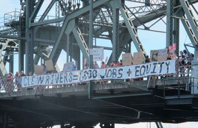
Whereas, In recognition of our history, and our obligation to repair, Portlanders remain committed to environmental protection, conservation, and stewardship, as well as creative efforts to inspire social and environmental change protecting Portland rivers and waterways.
Whereas, PDX SPLASH month is a month-long series of events taking place each July dedicated to water, river, and ocean awareness, specifically as it relates to the Willamette Valley, and it’s tributaries. Events include but are not limited to: outdoor activities, art events, educational symposiums, films, parades, and festivals. S.P.L.A.S.H. stands for Stewardship, Preservation, Local, Arts, Sustainability, and Heritage.
Whereas, PDX SPLASH month provides an opportunity for Portland creatives, local organizations, businesses, community, and advocacy groups as well as members of the public to participate and collaborate in activities all benefiting Portland’s mission to be a leading city in sustainability and environmental responsibility.
Now Therefore, I , Ted Wheeler, Mayor of the City of Portland, Oregon, the "City of Roses," do hereby proclaim every month of July to be
PDX S.P.L.A.S.H. month
In Portland and encourage all residents to observe this month.
Whereas, We also acknowledge the once open streams and lakes that existed across
Portland’s downtown, and what is now the NW industrial area. These waters included Tanner Creek, Couch Lake, Guilds Lake, and the Marquam Gulch which is now buried under I-5. The areas were destroyed for the purposes of creating sewer pipelines, and industrial expansion. In the beginning, Portland expansion efforts gave little thought to the indigenous communities living here, or the long-term consequences of pollution.
Whereas, In recognition of our history, and our obligation to repair, Portlanders remain committed to environmental protection, conservation, and stewardship, as well as creative efforts to inspire social and environmental change protecting Portland rivers and waterways.
Whereas, PDX SPLASH month is a month-long series of events taking place each July dedicated to water, river, and ocean awareness, specifically as it relates to the Willamette Valley, and it’s tributaries. Events include but are not limited to: outdoor activities, art events, educational symposiums, films, parades, and festivals. S.P.L.A.S.H. stands for Stewardship, Preservation, Local, Arts, Sustainability, and Heritage.
Whereas, PDX SPLASH month provides an opportunity for Portland creatives, local organizations, businesses, community, and advocacy groups as well as members of the public to participate and collaborate in activities all benefiting Portland’s mission to be a leading city in sustainability and environmental responsibility.
Now Therefore, I , Ted Wheeler, Mayor of the City of Portland, Oregon, the "City of Roses," do hereby proclaim every month of July to be
PDX S.P.L.A.S.H. month
In Portland and encourage all residents to observe this month.
Facts & Figures

Global Facts
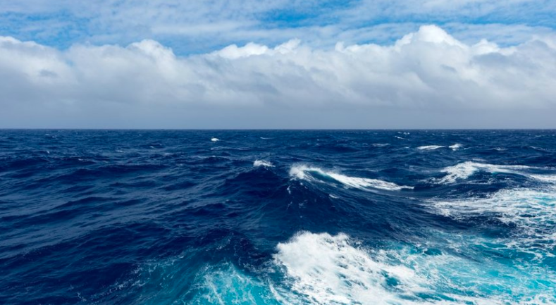
Oceans cover three quarters of the Earth’s surface, contain 97 per cent of the Earth’s water, and represent 99 per cent of the living space on the planet by volume.
Climate change
Resource:
www.un.org/sustainabledevelopment/oceans/
Climate change
- Oceans absorb about 30 per cent of carbon dioxide produced by humans, buffering the impacts of global warming.
- Carbon emissions from human activities are causing ocean warming, acidification and oxygen loss.
- The ocean has also absorbed more than 90per cent of the excess heat in the climate system.
- Ocean heat is at record levels, causing widespread marine heatwaves.
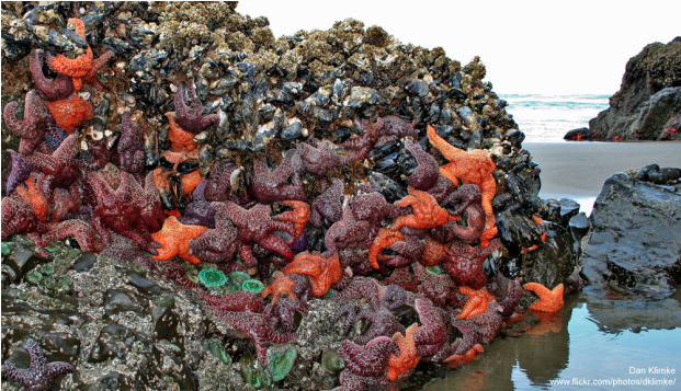
- Over three billion people depend on marine and coastal biodiversity for their livelihoods.
- Globally, the market value of marine and coastal resources and industries is estimated at $3 trillion per year or about 5 per cent of global GDP.
- Marine fisheries directly or indirectly employ over 200 million people.
- Coastal waters are deteriorating due to pollution and eutrophication. Without concerted efforts, coastal eutrophication is expected to increase in 20 percent of large marine ecosystems by 2050.
- Roughly 80per cent of marine and coastal pollution originates on land – including agricultural run-off, pesticides, plastics and untreated sewage.
- Around the world, one million plastic drinking bottles are purchased every minute, while up to 5 trillion single-use plastic bags are used worldwide every year
- Around 680 million people live in low-lying coastal zones – that is expected to increase to a billion by 2050.
- Sustainable and climate-resilient transport, including maritime transport, is key to sustainable development. Around 80 per cent of the volume of international trade in goods is carried by sea, and the percentage is even higher for most developing countries
Resource:
www.un.org/sustainabledevelopment/oceans/

Local Facts
Willamette River
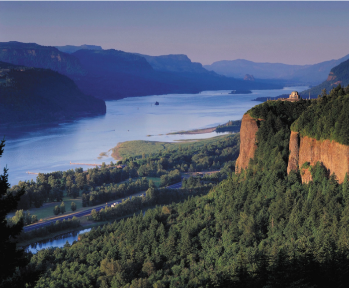
The mainstem Willamette flows 187 miles north from the confluence of the Middle and Coast Fork Willamette Rivers, to its confluence with the Columbia River.Bound by the Cascade Mountain Range to the east and the Coast Range to the west, the Willamette Basin is the largest watershed entirely contained within the state, draining 11,487 square miles- that’s nearly 12% of the Oregon!
It is the 13th largest river by volume within the U.S., and also claims the 2nd largest waterfall by volume in the U.S. at Willamette Falls in Oregon City (2nd only to Niagara).
There are 13 significant tributaries, and 13 U.S. Army Corps dams, as well as other private dams, along Willamette tributaries, resulting in a highly regulated flow on the mainstem.
One of the key source waters of the Willamette system is Waldo Lake, one of the purest lakes in the world, in contrast to the highly polluted Superfund site located at the “end” of mainstem river, where it flows into the Columbia.
The river winds its way through Oregon’s most populous cities including Eugene, Salem, and Portland, in addition to farmlands, forests, and quiet towns.
70% of Oregon’s population lives in the Willamette Valley, and most of those residents live within a 20 minute drive of the river.
The Willamette River Greenway System, started in the early 1970s and conceived by Governor Bob Straub, now has over 10,000 acres along the Willamette River. Most of it is owned by the Oregon State Parks and Recreation Department, with some additional lands owned by the Oregon Department of State Lands. Some of these lands are large developed Parks, and others are undeveloped natural areas along the river.
Resource: willamette-riverkeeper.org/basicsfacts
Columbia River
The Columbia River is the largest river flowing into the Pacific Ocean from North America. It is exceeded in discharge on the continent only by the Mississippi, St. Lawrence, and Mackenzie rivers.
The Columbia is one of the world’s greatest sources of hydroelectric power and, with its tributaries, represents a third of the potential hydropower of the United States. In addition, its mouth provides the first deepwater harbor north of San Francisco.
Two-fifths of the river’s course, some 500 miles (800 km) of its 1,240-mile (2,000-km) length, lies in Canada, between its headwaters in British Columbia and the U.S. border.
The Columbia drains some 258,000 square miles (668,000 square km), of which about 85 percent is in the northwestern United States. Major tributaries are the Kootenay, Snake, Pend Oreille, Spokane, Okanogan, Yakima, Cowlitz, and Willamette rivers. High flows occur in late spring and early summer, when snow melts in the mountainous watershed. Low flows occur in autumn and winter, causing water shortages at the river’s hydroelectric plants.
The Columbia flows from its source in Columbia Lake, at an elevation of 2,700 feet (820 meters), in British Columbia near the crest of the Rocky Mountains, to the Pacific Ocean at Astoria, Oregon. For the first 190 miles (305 km), its course is northwesterly. It then flows to the south for 270 miles (435 km) to the border of Canada and the United States (elevation 1,290 feet [390 meters]), where it enters northeastern Washington.
Animal life was abundant and varied prior to white settlement. Notable were the great runs of salmon and steelhead trout; populations of beavers, deer, elk, bears, and bighorn sheep; flocks of waterfowl and upland birds, including eagles, ospreys, hawks, and falcons; and numbers of western rattlesnakes.
The ability of the region to sustain large populations of wildlife has been drastically reduced, especially for salmon and beavers. Bald eagles and peregrine falcons were once listed as endangered but have recovered in numbers throughout the region.
There has been continued concern over the declining number of salmon, despite the presence of fish ladders and other passage facilities designed to make possible the continued annual upstream run of spawning salmon beyond dams on the river.
Native vegetation at lower elevations of the interior basin is mostly of the shrub-steppe variety, dominated by sagebrush and bunchgrasses.
With increasing elevation, shrub-steppe gives way to ponderosa pines and then to firs, larches, and other pines.
More than half of the original shrub-steppe vegetation has been eliminated by grazing and farming. Cheatgrass has become a troublesome invader.
Greasewood and alkali salt grass dominate on poorly drained saline soils, while willows and black cottonwoods dominate along watercourses. West of the Cascades, forests of Douglas firs with hemlocks and western red cedars prevail in upland areas.
Resource: www.britannica.com/place/Columbia-River
